
Here’s the lastest weather forecast for the Bahamas, compliments of Chris Parker, the cruiser’s best friend. He comes on the radio (single side band) every morning at 6:30 am to share his wisdom, then we receive an email copy of his forecast about 10:00 am (via satellite phone). Thus on any given day, we can get completely overwhelmed with weather details in two different formats!
Chris broadcasts weather six days a week from his boat, Bel Ami, in Southern Florida. He’s very accurate and thus has many fans/subscribers who tune in before finalizing any travel plans. It’s particularly fun to listen in on Sundays (the day he doesn’t broadcast) to see how many cruisers have forgotten what day it is - something that is easy to do out here!
For an extra fee, cruisers can call in and ask questions specific to their travel plans. We choose to just listen in and hope there’s someone going our way....
Sample conversation:
Boater: “Chris, we’re in Allen’s Cay and want to go to Nassau in the next day or two. You said the winds will be strong from the NW until Friday, but we’d really like to leave tomorrow... what do you think?”
Chris: “It could be a great trip for you if you enjoy winds on the nose at 30 knots and 10 foot seas. Otherwise, I might suggest you wait until things moderate on Saturday.”
He’s always really nice to everyone... there’s no such thing as a stupid question if you’re paying your monthly fee (of course, if you’re just listening in on the radio there are plenty of ‘em); plus Chris tries to respect that everyone has different ideas about what makes for a “good” sailing day.
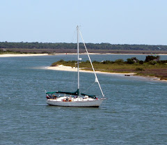
Now for your quiz: Using the forecast data below, on what day should Jubilee plan to leave Black Point (Exumas/Southern Bahamas) to head North along the Western banks of the Exumas? Keep in mind, we don’t like to travel in seas greater than 4-6 feet or winds greater than 15-20 knots. Certain members of our crew get seasick if it’s too rough.
There’s a “junior weather ranger” certificate coming your way if you get the correct answer!
(Drew did this same exercise recently for his science lesson thanks to an online resource we came across called floatingclassroom.com - a website set up by a “teacher turned cruiser” from Canada.)
Wx Update, Bahamas, TueApr1, 10a
Morning Graphical QuickScat: Strongest winds lie mostly N of SE Bahamas
/ E of C Bahamas, with E@25-30-40k, with a few squalls SE of T&C to
40-50k. SE Bahamas varies from E-ESE@15-20 to 30k in scattered squalls
/ C Bahamas mostly E-ESE@15-22, with isolated 25-30k squalls / NW
Bahamas ESE-SE@15-20.
IMAGERY:
Strongest squalls continue to lie NE of FrontalTROF...NE of line
20N/70W...GreatInaugua...CatIsland - this area includes T&C and
Mayaguana and waters N of Acklins, and SWNA waters as far N as 25N / as
far E as 70W. Isolated showers & milder squalls elsewhere. Strong
squalls near GulfStream off Carolinas, E of 80W seem persistent.
SYNOPSIS:
Today...HI NE of Bermuda this morning flattens into E-W-RIDGE 32N,
centered E of Bermuda, extending to FL-GA border. TROF S Bahamas. LO
GreatLakes trails ColdFRONT to Louisiana.
Tomorrow...Squally ColdFRONT exits US late tonight, with 25-35k NE winds
behind FRONT N of 32N. RIDGE 32N, but W extent shifts ti N FL &
weakens...allowing NW Bahamas winds to moderate & keeping ColdFRONT
along of 32N. RIDGE forces Bahamas TROF S-ward, bringing peak wind &
squalls S&W into the C & SE Bahamas tonight & tomorrow.
Thu3...weak reinforcing RIDGE exits NewJersey, beginning to merge with
weak RIDGE 28N. Squally FrontalTROF persists 32N. Bahamas winds become
more-uniform...moderating some C & SE / rebuilding NW Bahamas.
Fri4...TROF along S Bahamas weakens or dissipates, allowing slight
additional moderation C & SE Bahamas. Strong LO Pennsylvania trails
ColdFRONT to possible 2nd-ary LO Louisiana. NW Bahamas winds clock but
do not moderate. SE US clocks SW, but builds over 20k.
Sat5...Squally ColdFRONT along US E Coast from FL-GA border NE-ward,
preceded by SW winds to 30-35k in GulfStream N of 30N or 32N. RIDGE
persists ENE of Bahamas. Continuing gradual moderation C & SE Bahamas /
clocking but no moderation NW Bahamas.
OUTLOOK:
ColdFRONT enters NW Bahamas Sun6, with 15-20k clocking winds, higher in
squalls, followed by moderate N-NE winds thru Mon7. FRONT should weaken
& stall near N Part of C Bahamas late Sun6, with further moderation C &
SE Bahamas. As FRONT stalls & dissipates Mon7 into Tue8, SE Bahamas
probably becomes light E-ENE, providing excellent opportunity for
ESE-bound vessels. NW & C Bahamas mostly light E-quadrant winds. LATER
next week..."Zonal" flow with slow-moving LOs/FRONTs N of area prevent
any strong HI pressure, and next LO/FRONT doesn't move into E US till
weekend of Apr12.
F'cst:
Precip:
Abaco: isolated showers & a few squalls thru tomorrow, but unstable
atmosphere tomorrow could support isolated squalls to 30k-or-more.
Little activity Thu3 thru Sat5, but squalls Sun6 with FRONT.
Exumas: increase in coverage of scattered showers & squalls to 30-40k
thru tomorrow, then little activity.
SE Bahamas: scattered showers & squalls to 30-40k thru Thu3 morning,
then little activity.
WIND:
Abaco: 110@20 & gusty this morning; 120@16 late, 14k tomorrow; 110@16
tomorrow night into Thu3; 120@17 Thu3; 150@17 Fri4; 180@15-20 Sat5.
N Exumas: 100-110@20 today, 17k tonight, 20G23k tomorrow, 19G22k Thu3;
130@19G21 Fri4; 150@16 Sat5 morning, 14k afternoon.
S Exumas: 100@20 today, 22G25k tomorrow into Thu3; 110@21G24 late;
120@20G23 Fri4; 135@19 Sat5 morning, 15k afternoon.
SE Bahamas: 090-100@20 this morning, 23G27k afternoon thru Thu3 morning,
22G26k Thu3; 110@22G26 Fri4; 120@21 Sat5 morning, 18k late.
SEAS:
Abaco: 11'/9-sec from ENE-E today, 9' tomorrow, 8' tomorrow night, 7-8'
from E Thu3, 6' Fri4 & Sat5.
C Bahamas: 12'/9-sec from ENE today, 11' tomorrow, 8-9' Thu3; 6-7'/8-sec
from ESE Fri4 into Sat5; 6' late.
SE Bahamas: 13'/9-sec from ENE today & tomorrow, 10' Thu3, 9' from E
Fri4, 8-9' Sat5.
CROSSING:
Tomorrow may just work for some, with mild ESE winds, and just a little
isolated squall activity...problem is 6' seas N of 27N for vessels
heading N-NW. W-bound sailors may also do OK Thu3 & Fri4, with settled
conditions, and moderately-strong ESE-SSE winds. E-bound sailors could
do better late Fri4 & Sat5 as moderately-strong winds clock SSE-SSW,
though risk for squalls increases Sat5.
N ROUTE: 120@17, 5' today, 12k, 3' tonight & tomorrow; 120@16, 4' Thu3;
150@17, 5' Fri4; 170@20, 6' Fri4 night; 200@15-20, 5-6' Sat5. Isolated
squalls to 30-40k tomorrow & again Sat5. N of 27N ENE swells 8'/9-sec
today, 7' tomorrow morning, 6' late, 5-6' thereafter.
S ROUTE: 110@19, 6' today, 13k, 4' tonight & 3' tomorrow; 15k, 4'
tomorrow night, 18k, 5' Thu3; 140@18 Fri4; 190@15, 4' Sat5. Similar
squalls.
N AREAS:
General: more-favorable conditions possible after Sat6's ColdFRONT thru
most of next week.
N FL & GA: SSE@10-15 today, S@5-10 tonight into tomorrow; ESE@10 late;
SE@10-15 Thu3; S@20 Fri4, 25k & squally Fri4 night, SW Sat5...persistent
5-6'/9-sec E swells, plus wind-chop, resulting in confused seas.
Carolinas: S@20 & squally today, SW tonight; NE@25-35 & squally tomorow;
SE@20 Thu3; SSW@20-25 Fri4, 25-35 & squally late thru Sat5...persistent
6-10'/8-sec seas from ESE, resulting in confused seas.


2 comments:
Keep in mind I teach NO SCIENCE whatsoever and there is a reason for it. Anywho...April 7 and 8 would be good for your trip.
Hi Guys,
Great stuff! Too bad you will miss Baltimore on the return but your plans make a lot of sense. We love to hear what all of you have to say. Your experiences are priceless.
Love to all, and be safe.
Uncle Dave & Gigi
Post a Comment